
(AccuWeather) Confidence continued to grow among AccuWeather‘s expert team of meteorologists on Sunday that a significant storm would evolve later this week, threatening to bring a wide swath of snow, rain and fierce winds from the Plains to the Atlantic Seaboard.
The intensifying storm will coincide with a surge of frigid air that will send temperatures to bone-chilling levels through the holiday weekend and could be one of the most intense and prolonged periods of Arctic air in decades during Christmastime. The plummeting temperatures with the storm could also lead to concerns of a rapid freeze-up.
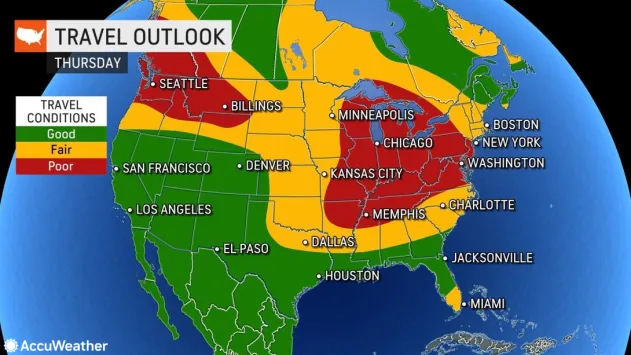
The storm’s timing could not be worse given the increased number of travelers leading up to Christmas as well as the pressure retailers and shipping companies face to keep shelves stocked and items on track for delivery.

Snow during at least part of the storm is likely to extend from parts of the southern Plains to the Midwest, Northeast and perhaps even the interior Southeast states during the period from Thursday, Dec. 22 to Saturday, Dec. 24. The first stage of the storm can cause snow to break out as early as Wednesday across the interior West, with Denver expected to pick up several inches of accumulation Wednesday night.
AccuWeather’s team of long-range meteorologists, led by Senior Meteorologist Paul Pastelok, not only looks at computer models but also examines existing global weather patterns, known as teleconnections. The team has been keeping a close eye on the potential for this storm and the geographical area at risk since the start of December.
“At this time, there is every indication to believe that a major storm will unfold and track from somewhere over the South Central states to the Northeast,” Pastelok said.

The track is key to which areas end up with the heaviest snow, but confidence is also growing that even a small or moderate amount of snow when combined with plunging temperatures and strong winds will lead to a quick freeze-up and slippery travel from parts of the south-central Plains to the Midwest and Northeast states.
This means that cities such as St. Louis and Nashville, and perhaps as far south as Dallas and Atlanta could be looking at some snow, as well as the more traditional wintry trouble spots farther north such as Chicago, Detroit and Pittsburgh.
“This is the type of setup that can lead to ground blizzards in parts of the Central states,” AccuWeather Senior Long-Range Meteorologist Joe Lundberg said when he considered the potential storm’s intensity, the arrival of Arctic air and the wide open terrain in the region.
“This storm will likely become intense, feeding on the extremely sharp variation between the surging arctic air arriving from the Central states and relatively warm air across the southeastern U.S.,” AccuWeather Chief Meteorologist Jon Porter said. “Major East Coast storms over the decades have occurred in this type of setup, bringing the risk for heavy snow and rain, gusty winds, coastal flooding, severe thunderstorms and even tornadoes on the southern side of the storm.”

AccuWeather’s Chief On-Air Meteorologist Bernie Rayno has summarized the major impacts of the coming storm and cold this week.